|
|
|
|
|
NAMIBIE |
 |
NAMIBIA |
|
Août 2005 |
|
August, 2005 |
|
Le Parc National d' ETOSHA |
|
The ETOSHA National Park |
|
La
Région de NAMUTONI |
|
The
NAMUTONI Area |
|
Le
CAMP et les
PAYSAGES |
|
The
CAMP and the
LANDSCAPES |
|
Situé dans le nord de la
Namibie (Province d'Oshana) |
|
Located
in the north of the Namibia (Province of Oshana) |
|
Parc de 22 270km2
- Fondation en 1907 - Devenu parc national en 1958 |
|
Park of 8 600 sqm - Foundation in
1907 - Become national park in 1958 |
|
Situé à environ : 420km de Windhoek - 1385km de Johannesbourg - 1675km du Cap |
|
Located at approximately : 260 miles of Windhoek - 860 miles of Johannesburg -
1040 miles of
Cape Town |
|
|
|
|
|
Carte de situation dans le nord du pays |
 |
Map of position in the north of the country |
|
Carte de situation dans le parc |
|
Map of position in the park |
|
Carte de la région |
|
Map of the area |
|
|
|
|
|
|
|
|
|
 |
 |
 |
 |
|
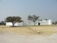
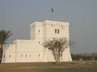
Le fort de Namutoni |
Le fort de Namutoni |
Le fort de Namutoni |
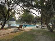
La piscine du camp |
|
The fort of Namutoni |
The fort of Namutoni |
The fort of Namutoni |
The swimming pool of the camp |
|
|
|
|
|
 |
 |
 |
 |
|
Un point d'eau |
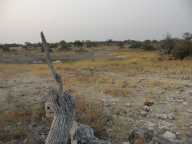
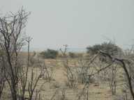
Le bush |
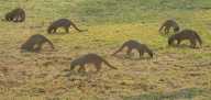
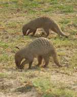
Des mangoustes dans le camp |
Des mangoustes dans le camp |
|
A waterhole |
The bush |
Some mangeeses in the camp |
Some mangeeses in the camp |
|
|
|
|
|
 |
 |
 |
 |
|
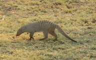
Une mangouste dans le camp |
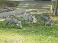
Des phacochères dans le camp |
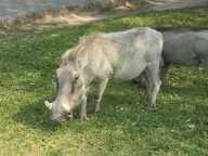
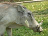
Un phacochère dans le camp |
Un phacochère dans le camp |
|
A mangoose in the camp |
Some warthogs in the camp |
A warthog in the camp |
A warthog in the camp |
|
|
|
|
|
 |
 |
 |
 |
|
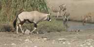
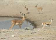
Antilopes et zèbres autour d'un point d'eau |
Antilopes autour d'un point d'eau |
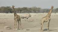
Antilope et girafes dans le bush |
Zèbres et autruche autour d'un point d'eau |
|
Antelopes and zebras around a waterhole |
Antelopes around a waterhole |
Antelope and giraffes in the bush |
Zebras and ostrich around a waterhole |
|
|
|
|
|
 |
 |
 |
|
|
Antilopes autour d'un point d'eau |
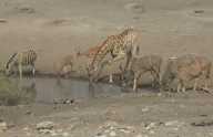
Antilopes, girafe et zèbre autour d'un
point d'eau |
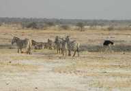
Zèbres, gnou et phacochère autour d'un
point d'eau |
|
|
Antelopes around a waterhole |
Antelopes, giraffe and zebra around a
waterhole |
Zebras, gnu and warthog around a waterhole |
|
|
|
|
|
|